Table of Contents
Which river is known as the longest river in India?
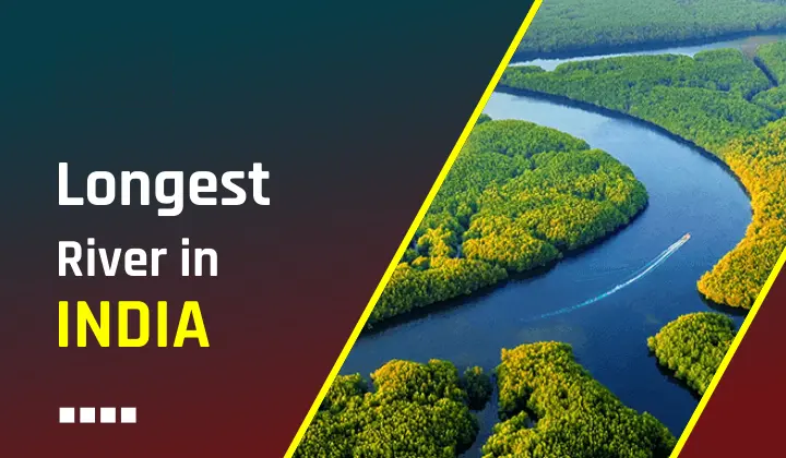
Longest River in India: India is a diverse country having an extensive network of rivers in both the Himalayas and the Peninsular region. Ganga is known as the longest river in India and originates from the Gangotri glacier in Uttarakhand out of several rivers of the country. Ganga is also worshiped in India with great importance and taking a bath in the holy water of Ganga is considered good.
Indian rivers help keep the country fertile as it provide irrigation to the farmers and industries too. Around 90% of India’s rivers flow through the eastern part of the country and others into the western part of the country. Easter rivers fall into the Bay of Bengal and western rivers fall into the Arabian Sea. Read the below article and learn all the facts and important information about the 10 longest rivers in India.
Longest River in India: Interesting Facts
- In 2008, the Ganga was designated as the National River of India by former Prime Minister Dr. Manmohan Singh.
- Ganga is a transboundary river that flows between two countries India and Bangladesh.
- After reaching Bangladesh, the name of the longest river in India i.e. Ganga changes into Padma River.
- The Ganga action plan was started to improve the quality as it was polluted in 1985
- The holy locations along the longest river in India are Haridwar, Varanasi, Gangotri, and Kali Ghat.
Top 10 Longest Rivers in India
The Top 10 Longest Rivers of India along with their origin, length (in km), and total length are as follows:
| S.No. | River | Origin | Length in India (km) | Total Length (km) |
|---|---|---|---|---|
| 1 | Ganga | Gangotri Glacier | 2525 | 2525 |
| 2 | Godavari | Triambakeshwar, Maharashtra | 1464 | 1465 |
| 3 | Krishna | Near Mahabaleshwar, Maharashtra | 1400 | 1400 |
| 4 | Yamuna | Yamunotri Glacier | 1376 | 1376 |
| 5 | Narmada | Amarkantak, Madhya Pradesh | 1312 | 1312 |
| 6 | Indus | Tibet, Kailash Range | 1114 | 3180 |
| 7 | Brahmaputra | Angsi Glacier (Tibet) | 916 | 2900 |
| 8 | Mahanadi | Hills of Southeastern Chhattisgarh | 890 | 890 |
| 9 | Kaveri | Talakaveri, Karnataka | 800 | 800 |
| 10 | Tapti | Satpura Range near Multai, Madhya Pradesh | 724 | 724 |
Longest River in India
The detailed information provided below is of the top 10 longest rivers in India. The longest river in India is the Ganga River. Candidates can read the detailed article for information related to the Longest River in India.
Ganges River: 2525 KM
The Ganges, known as Ganga in India is the most sacred river to Hindus and is worshipped as the goddess Ganga. Sadly, it is one of the most polluted rivers in the world too. The Ganges is the longest river in India and also the largest river in India. Rising in the Himalayas, it originates from the Gangotri Glacier in Uttarakhand and empties into the Bay of Bengal, Ganges drains one-fourth of the territory of India, and its basin supports hundreds of millions of people. The Ganges is one of the longest rivers in the world. The states that are covered by this waterbody are Uttarakhand, Uttar Pradesh, Bihar, and West Bengal. The last part of the Ganges ends in Bangladesh.
Godavari River: 1464 KM
The Godavari is also one of the longest rivers in India after the Ganges. It has been revered in Hindu scriptures for many millennia and continues to harbor and nourish a rich cultural heritage. The Godavari is the longest river in Southern India and is also known as the ‘Dakshina Ganga’. The river originates from Triambakeshwar, Nasik in Maharashtra passes through Chhattisgarh, Telangana, and Andhra Pradesh, and drains into the Bay of Bengal covering a length of over 1450 Km.
Krishna River: 1400 KM
Krishna River (also known as Krishnan) originates from the Western Ghats near Mahabaleshwar in Maharashtra. It is one of the most important peninsular rivers in India running through the states of Maharashtra, Karnataka, and Telangana, and finally emptying into the Bay of Bengal in Andhra Pradesh.
Yamuna River: 1376 KM
River Yamuna is the longest tributary river of the Ganges. The Yamuna originates from the Yamunotri glacier at the Banderpoonch peak in Uttarkashi, Uttarakhand. It traverses the states of Uttarakhand, Delhi, Himachal Pradesh, Haryana, and Uttar Pradesh covering a distance of 1,376 km.
Narmada: 1312 KM
River Narmada (also called Rewa) is the largest west-flowing river in Peninsular India. Narmada originates from the Amarkantak range of mountains in Madhya Pradesh. It is one of the seven holy rivers in India and has been mentioned in various ancient scripts of Hindus. The river merges into the Arabian Sea after covering over 1300 km.
Indus River: 1114 KM
The Indus River, the cradle of the ancient Indus Valley civilization, bears significant historical importance. It’s even believed that our nation takes its name from this grand river. Originating from Lake Mansarovar, the Indus River flows through Ladakh, Gilgit, and Baltistan, eventually entering Pakistan. The Indus Waters Treaty, a pact between India and Pakistan, grants India the right to use 20% of the river’s total water.
Among the primary tributaries of the Indus River are the Kabul River, Jhelum River, Chenab River, Ravi River, Beas River, and Sutlej River. The complete length of the Indus River spans 3180 kilometers, of which 1114 kilometers lie within India.
Brahmaputra: 916 KM
The Brahmaputra, one of the major rivers in India, originates in the Angsi glacier of the Himalayas in Tibet. There it is known as the Yarlung Tsangpo River. The River enters India via Arunachal Pradesh. It then traverses through Assam and finally enters Bangladesh. Brahmaputra delta is home to 130 million people and 6, 00, 000 people living on the riverine islands, and the river is popularly known as the ‘Lifeline of Assam’.
Mahanadi River: 890 KM
Mahanadi is a compound of the Sanskrit two words maha (“great”) and Nadi (“river”) which means great river. The river originates in the Sihava mountains of Chhattisgarh and flows its major through the state of Odisha. Mahanadi River deposits more silt than any other river in the Indian subcontinent. The world’s largest earthen dam: Hirakud Dam has been constructed on the Mahanadi river near the Sambalpur city in Odisha. Behind the Hirakund dam is a 55 km long Hirakud reservoir that forms one of the longest artificial lakes in Asia.
Kaveri: 800 KM
Kaveri or Cauvery is the largest river in Tamil Nadu. Kaveri originates from the foothills of Western Ghats at Talakaveri in the Kodagu district of Karnataka. The river flows in a southeasterly direction through the states of Karnataka and Tamil Nadu and empties into the Bay of Bengal, Tamil Nadu. Along its journey from Kodagu hills to the Deccan plateau, the Kaveri River forms two islands in Srirangapatna and Shivanasamudra. River Kaveri is also known as the Ganges of the South
Tapti River: 724 KM
Tapti River Tapti originates in Peninsular India and flows through Madhya Pradesh, Maharashtra, and Gujarat, and empties into the Arabian Sea. It is one of only three peninsular rivers in India that run from east to west. Tapti River nurtures and supports wildlife in the Melghat forest which is famous for its rich flora and fauna.


 States and Capitals in India, List of 28...
 List of Presidents of India from 1950 to...
 National Parks of India, Check Full List

